Enhance Your TrainingPeaks Experience with Virtual Map Overlay
The TrainingPeaks Virtual Map Overlay is a Chrome extension designed to enhance the way users visualize their virtual activities. This free tool overlays satellite imagery of the TrainingPeaks Virtual world onto activity maps, allowing users to better understand and share their routes. It operates seamlessly across various platforms, including TrainingPeaks, Strava, VeloViewer, and Intervals.icu, without requiring any configuration or setup.
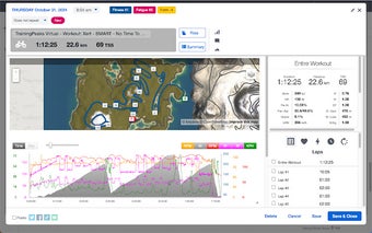
With this extension, users can easily match their activities to the actual terrain of Mussau Island in Papua New Guinea, the specific area represented in the virtual overlay. This feature is particularly useful for athletes looking to visualize their routes or share detailed screenshots of their training experiences. The overlay enhances the overall user experience, making it a valuable tool for anyone utilizing TrainingPeaks for their virtual training activities.